As Debby moves away, ‘We really dodged a bullet’
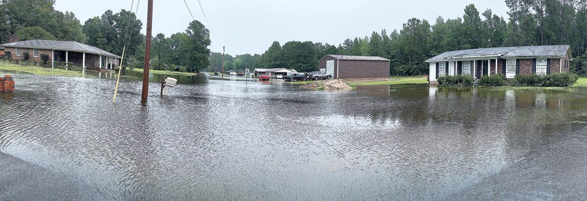
A panoramic view of Twin City Circle just off of US 701 Thursday afternoon. (Deuce Niven, TLT)
By DEUCE NIVEN
tribdeuce@tabor-loris.com
Some street flooding and little wind impacts were the legacy of Tropical Storm Debby as she moved through the Tabor-Loris Community Wednesday night and into Thursday.
“We really dodged a bullet,” Tabor City Fire Chief Jeff Fowler said.
Firefighters worked until about 2 a.m. Thursday, responding to high water calls and just one or two reports of trees downed during the storm.
“We really didn’t get much in the way of wind,” Fowler said.
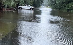
Homestead Drive near Loris High School. (Jenn Boyd, TLT)
Street flooding in Tabor City disappeared by dawn, Fowler said. Other areas had more, especially Loris, which received much more rainfall from the storm that early deluged parts of Florida, Georgia, and southeastern South Carolina.
NWS rain total posts for the area that includes Tabor City and Green Sea showed 10 inches or less rain between 8 a.m. Monday and Thursday, while a rain gauge at the Horry County Government Building in Loris recorded 15.89 inches for the period.
That brought flooding to some of the usual streets typically impacted by heavy rains, including Twin City Circle just off of US 701 north of SC 9 Bypass. High water there persisted well into Thursday afternoon, as rain from some of the later bands of Debby to pass through added to the misery of homes isolated by the water.
Numerous rural roads in Columbus and Horry were closed due to flooding Wednesday evening and into Thursday, with some of those impacts lingering and expected to grow more problematic as rainfall upstream as Debby crawled to the north makes its way downstream, a National Weather Service bulletin said.
Areas near Heritage Road, Coats Road and Graham Street in Loris, and Twin City Circle north of the city were flooded.

Water moves quickly over the spillway at the Lake Tabor dam Thursday morning. (Deuce Niven, TLT)
A Columbus County Sheriff’s Office Facebook post Wednesday night included nearly 60 roads with high water, some flooded and not possible, others where caution was urged.
Back to normal
County government offices in Columbus and Horry were closed Thursday, but will re-open at normal hours Friday, announcements from the respective governments said.
Public school and college operations in Horry County were all expected to be back to normal Friday, while those in Columbus County were less certain. Columbus County Schools spokesperson Kelly Jones said at 3:30 p.m. Thursday that a decision on operations for Friday was “still under review.”
Horry County’s Emergency Operations Center shut down Thursday, and the county returned to normal operations. Columbus County’s EOC was expected to close when the county’s regular offices re-open Friday morning, Assistant County Manager Nick West said.
There were no shelter openings in Horry, with four shelters opened in Columbus Wednesday. Three of the four, at South and West Columbus High Schools and East Columbus Jr./Ser. High School, were set to close by 5 p.m. Thursday.
One shelter, at Edgewood Elementary School in Whiteville, will remain open for now, a news release said. It was the only pet friendly shelter in the county, and a timetable for closing was not established Thursday.
Debby’s direct impacts should be gone by Friday, the National Weather Service reported, but another front moving from the west was expected to bring more rain during the weekend.
“Please continue to be careful when driving,” a Columbus County government news release said. “Rivers will continue to rise causing additional flooding. Do not drive on roads through water.”
Citizens with non-emergency storm related or questions are invited to call the county’s EOC storm line at 910-640-2208. – Includes reporting by Jenn Boyd